 NERC Data Catalogue Service
Top soil
Type of resources
Topics
Keywords
Contact for the resource
Provided by
Years
Formats
Representation types
Update frequencies
Scale
-
This layer shows data collected mainly by the Geochemical Baseline Survey of the Environment (G-BASE) programme. Geochemical data are available for soil samples for the Humber-Trent and East Anglia atlas areas (see the Geochemical atlas areas layer). Samples for East Midlands and part of Southeast England have been collected and are currently either undergoing analysis or data conditioning. More than twenty urban areas have also been sampled and top soil analyses are available for these urban areas (Belfast, Cardiff, Corby, Coventry, Derby, Doncaster, Glasgow, Hull, Ipswich, Leicester, Lincoln, Manchester, Mansfield, Northampton, Nottingham, Peterborough, Scunthorpe, Sheffield, Swansea, Stoke, Telford, Wolverhampton and York). Regional samples are collected at an average density of one site per 2 square kilometres, urban sampling is at a density of 4 samples per square kilometre. Top soil samples are collected at a depth of 5 - 20cm. It is sieved through a 2mm mesh and milled to less than 150 microns. The data include analyses for some or all of the following elements by XRFS: Mg, P, K, Ca, Ti, Mn, Fe, V, Cr, Co, Ba, Ni, Cu, Zn, Ga, As, Se, Rb, Sr, Y, Zr, Nb, Mo, Pb, Bi, Th, U, Ag, Cd, Sn, Sb, Cs, La, Ce, Ge, Sc, Se, Br, Hf, Ta, W, Tl, Te and I. Loss on Ignition (LOI) and pH (in a slurry of 0.01 M CaCl2 ) is now routinely determined on 50% of regional and all urban samples.
-
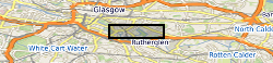
The UK Geoenergy Observatories (UKGEOS) Glasgow facility, baseline soil geochemistry dataset released from the BGS comprises an excel file with two spreadsheets. The first spreadsheet contains information on the chemical composition of 90 topsoil (0 - 20 cm) samples collected from seven initially proposed borehole sites for the UKGEOS Glasgow facility, and from two control sites, in February-March 2018 (03-18). Ten samples were collected from each site prior to installation of the UKGEOS Glasgow facility, and underwent laboratory analysis. Chemical data for pH and the total concentrations of 54 inorganic and 75 organic substances in the soil samples are presented. In addition, the dataset contains locational and descriptive information about the samples noted during sampling. The analyte name, element chemical symbols, analytical method, units of measurement and limits of quantification are recorded in header rows at the top of the spreadsheet. The dataset includes qualifiers, highlighting any quality control issues reported with the data. The data qualifiers are explained in the second spreadsheet released with the data. Further details about the dataset can be found in the accompanying report http://nora.nerc.ac.uk/id/eprint/527798/.
-
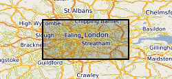
The London Earth data is part of a nationwide project to determine the distribution of chemical elements in the surface environment, namely Geochemical Baseline Survey of the Environment (G-BASE). London Earth focuses on the soil of the capital city, the limits of the survey being defined by the Greater London Authority (GLA) administrative boundary. Chemical elements have been determined by X-ray fluorescence spectrometry (XRFS) at the laboratories of the British Geological Survey (BGS) in Keyworth, Nottingham. These results are presented as a MS Excel file.